Arafura Oil Pty Ltd – Promising Potential
Highlights
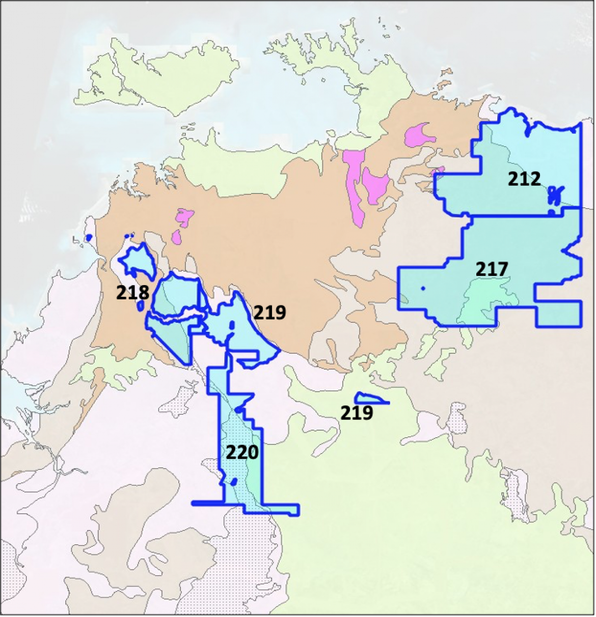
EPA218, EPA219 and EPA220 are located over part of the Daly Basin, laid down during the Ordovician to Proterozoic period. There has been no exploration across these areas.
EPA212 covers part of the Arafura Basin laid down during the Carboniferous to Neoproterozoic periods. There has been no exploration across this area.
EPA217 covers part of the greater McArthur Basin. Nearby exploration undertaken by Santos, Tamboran and Origin Energy have demonstrated the presence of large quantities of recoverable dry and wet gas much further south in the Beetaloo sub-Basin. The northward extent of these systems has not been established as there has been no exploration in or around EPA217.
Arafura Oil P/L and Bonaparte Oil P/L acreage
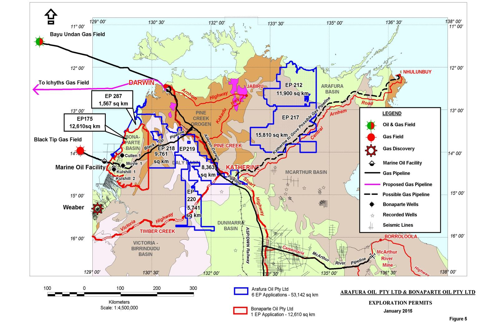
Arafura and Bonaparte acreage
3 separate areas
- EPA 175: onshore Bonaparte Basin
- EPAs 218, 219 and 220: Daly Basin section over prospective Proterozoic basins
- EPAs 212 and 217: onshore Arafura Basin sequence over prospective McArthur Basin sediments
Arafura Oil P/L: Daly Basin and Proterozoic acreage
- EPAs 218, 219, 220
- Close to infrastructure – Stuart Highway and Victoria Highway and gas pipelines
- Thin Daly Basin sediments overlying prospective Victoria and Birrindudu Basin sequences
- As noted earlier, these are equivalent to McArthur Basin sediments
- Recommended reading: NTGS 2014 report: page 190 (Daly); page 187 (Victoria); page 47 (Birrindudu); page 13 (McArthur)
Arafura Oil P/L: onshore Arafura Basin and McArthur Basin acreage
- EPA 212 and EPA 217
- Neoproterozoic to Permian Arafura Basin extends from onshore NT to Indonesian waters
- A lot of industry interest especially in EPA 217
- Offshore source rock kitchen is distal to the onshore section so most likely source is Proterozoic shales
- The EPAs have conventional and unconventional potential
- Recommended reading: NTGS 2014 report: page 195 (Arafura); page 13 (McArthur)
Wrafura Oil P/L, Bonaparte Oil P/L and MBS Oil P/L Geology
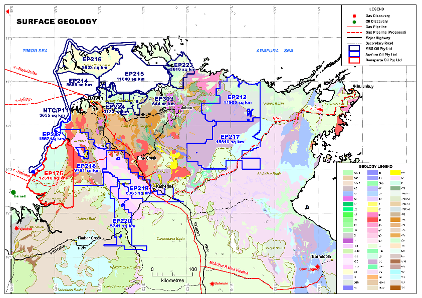
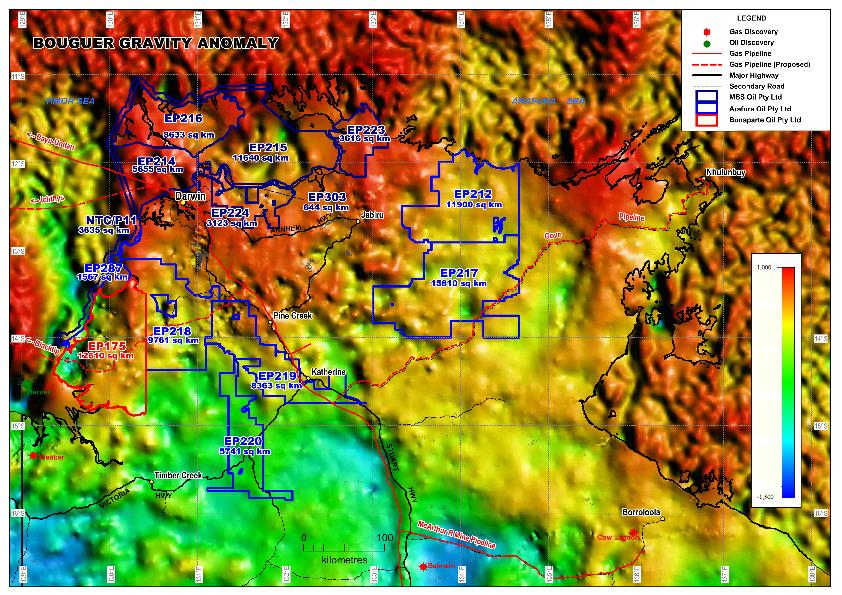
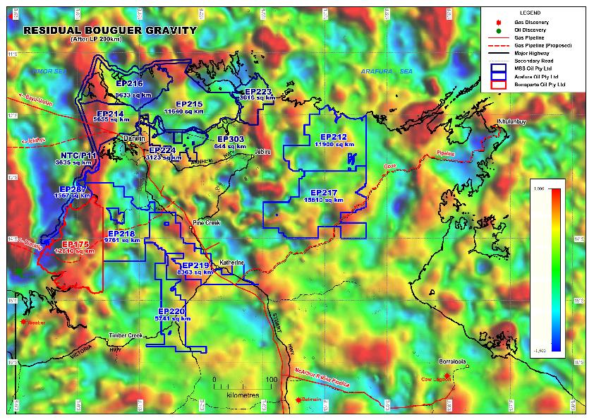
Arafura Oil P/L, Bonaparte Oil P/L and MBS Oil P/L: Gravity
